Author: CNR-ISMAR GIS map of conflicts, Distribution of human uses and conservation actions in a Marine Protected Area
The CNR-ISMAR training course, held from October 28th to 30th, 2024, introduced MPA managers and conservation practitioners to GIS fundamentals, equipping them with the skills to manage spatial data. Through theory sections, hands-on exercises and real-world applications, participants gained the tools to enhance marine conservation and resource management.
What is GIS?
Geographic Information Systems (GIS) are powerful tools for Marine Protected Area (MPA) managers, enabling effective decision-making through spatial analysis and visualisation of marine ecosystems. This training course was designed to introduce MPA managers to the fundamental principles and practical applications of GIS in the context of marine conservation and management.
Targets
This GIS training course was dedicated to MPA managers, marine scientists, policymakers, and conservation practitioners with little or no prior GIS experience who are looking to integrate spatial analysis into their work.

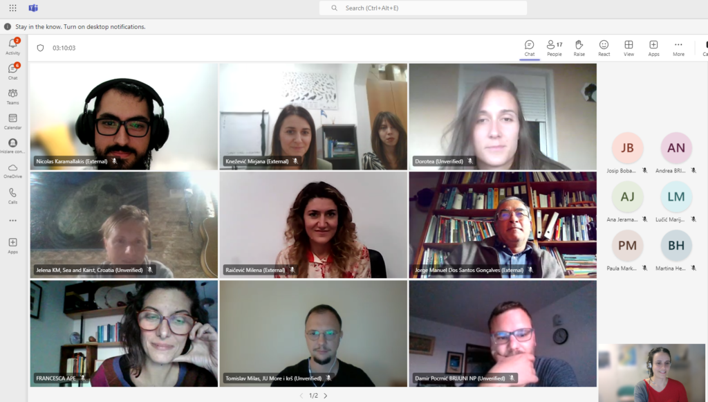
Author: CNR-ISMAR Participants of the GIS training course
Objectives of the GIS training
The course aimed to provide participants with a comprehensive understanding of GIS concepts and tools, establishing a strong foundation for using spatial data in the context of marine conservation. Through the training, participants learned how to collect, manage, and analyse spatial data relevant to MPAs, utilizing various sources such as satellite imagery, field surveys, and publicly available datasets.
Additionally, the course focused on developing practical skills for inputting and editing spatial data, enabling participants to create and refine maps that support planning, monitoring, and effective communication. A significant component of the training involved exploring The AMAre Geoportal, where participants gained hands-on experience with its functionalities and applications. This includes understanding how web services can be leveraged to manage marine resources, assess habitat changes, and monitor biodiversity effectively.
Key topics
The course begins with an introduction to GIS, highlighting its critical role in marine conservation and its applications in managing MPAs. Participants gained an understanding of spatial data types, including vector and raster formats, and explored various sources for obtaining such data. Fundamental data collection techniques, such as field surveys and remote sensing, were covered to ensure a practical grasp of gathering spatial information.
The training explored data management, focusing on querying and manipulating spatial datasets to extract valuable insights. A dedicated section addressed the importance of coordinate systems and georeferencing, equipping participants with the knowledge to ensure spatial accuracy in their analyses. Additionally, participants gained hands-on experience and explored the use of geoportals and web services for MPA management, learning to implement metadata effectively to enhance data organisation, accessibility, and usability in marine resource management.
Format and approach
The course included theoretical lessons with hands-on exercises using open-source GIS software, such as QGIS, to ensure accessibility and ease of use. Participants worked with real-world datasets to address common challenges in MPA management, such as identifying spatial features for an effective sampling strategy, classifying spatial data, querying and retrying information and digitising new data.
Theory, hands-on exercises, and demonstrations will soon be available through the MPA4Change Training Platform.
Outcomes
By the end of the training, participants reached the confidence and skills to use GIS for mapping and spatial analysis, empowering them to make data-driven decisions that enhance the management and conservation of MPAs.
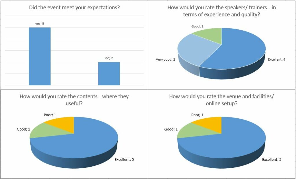
We received positive feedback from participants now ready to start working with GIS!

Author: CNR-ISMAR Survey results, Graphs summarizing the results of the survey submitted to the GIS course participants


